Barracks
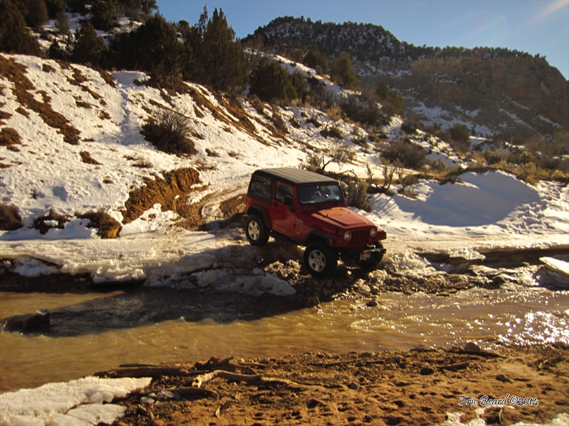
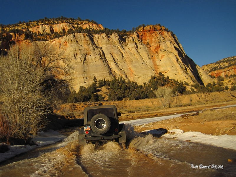
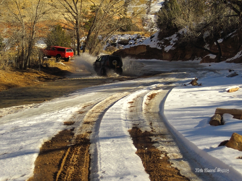
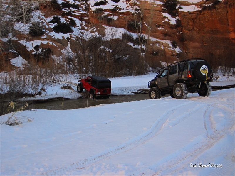
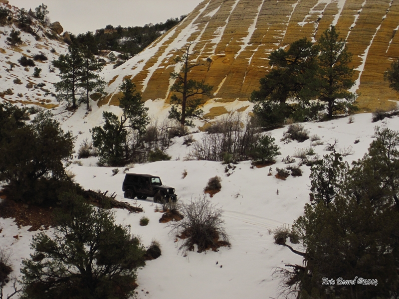
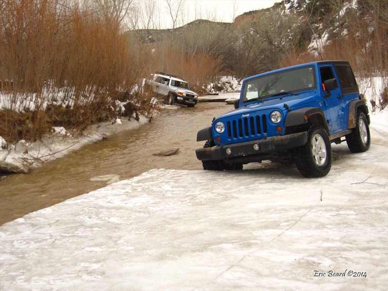
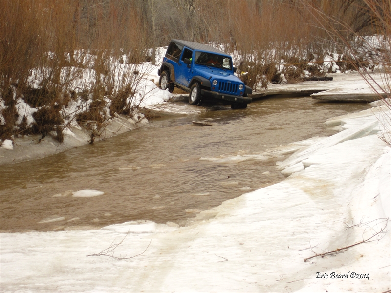
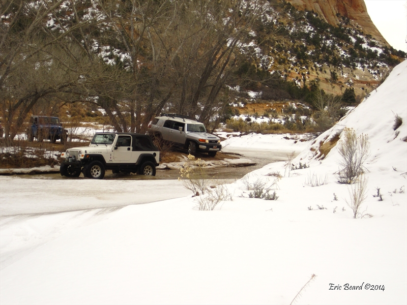
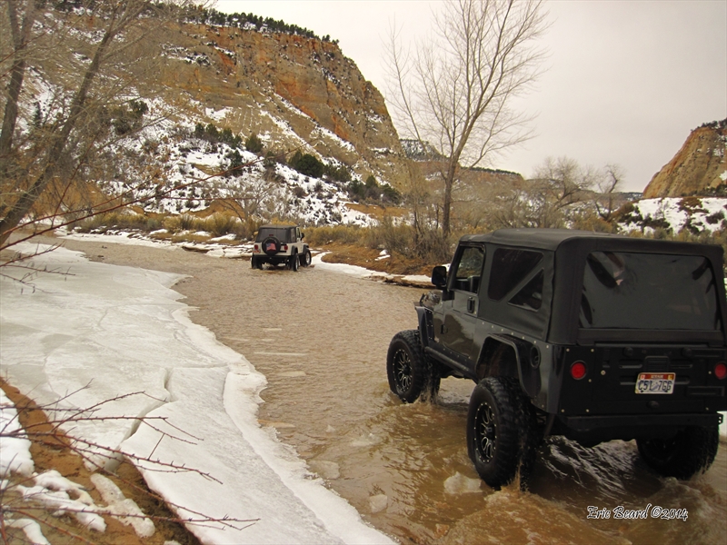
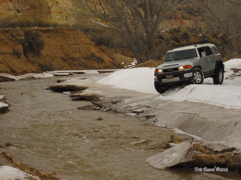
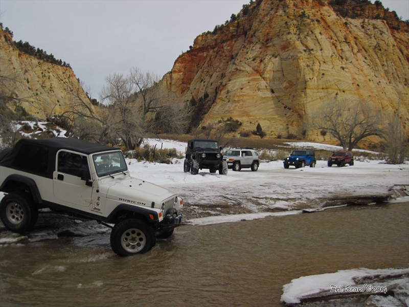
The Barracks trail features the magnificent scenery that Zion Park is famous for, with none of the crowds. Along the way, you will cross the East Fork of the Virgin River over 20 times. Drive along the banks amongst the cottonwoods and willows, below colorful rock canyon walls that tower almost 1,000 feet above you. Some of the banks are steep and muddy, and there are a couple of slickrock climbs that will earn the rating of this trail. Especially in winter, this is an incredible trail.
NOTE: This trail may be hazardous in winter. The trail leader will prerun the trail and update prior to leaving the staging Area. Alternate routes may be required.
Scenery
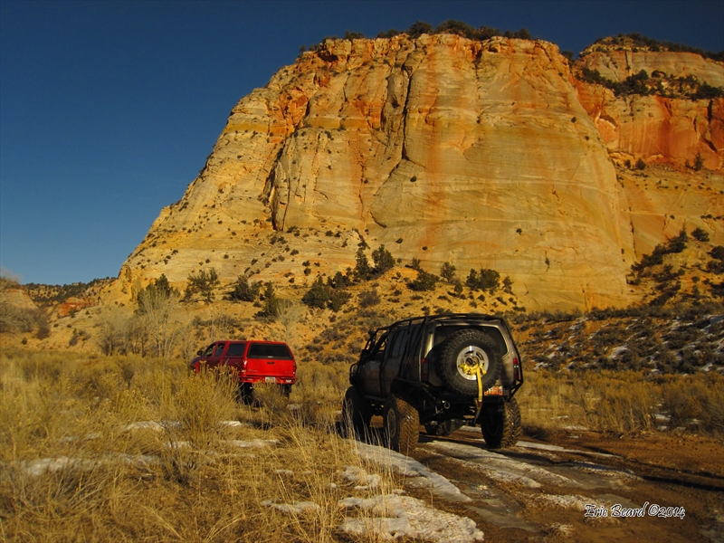
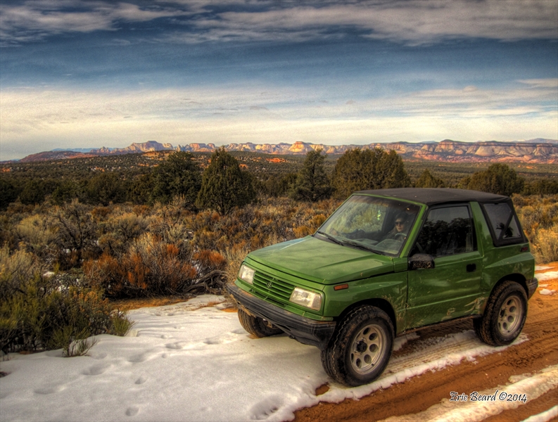
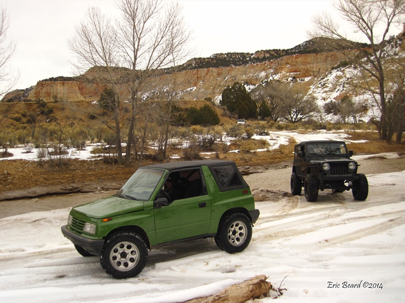
The highway trip to the trailhead climbs from Hurricane City up to the top of the Hurricane Cliffs, below Smithsonian and Gooseberry Mesas. As you drive through the towns of Apple Valley, Hilldale, and Colorado City you pass below Kanaan Mountain. The route leaves highway 59 at Cane Beds road and heads north to Coral Pink Sand Dunes, turning west at Elephant Gap road, where the trail begins. At first, you are on sandy two-track winding between juniper trees and sage brush. After passing by Elephant Butte, the road turns north at the base of mesas through a couple of canyons. After the canyons, the trail descends 800 feet on a sand hill to the first crossing of the East Fork of the Virgin River. As you make over 20 crossings, you are at the base of sandstone cliffs on both sides.
Surface
110 miles are paved highways, with 5 miles of sandy county road. The Barracks trail starts off the Sand Dunes road at Coral Pink Sand Dunes and heads west through Elephant Gap on sandy two-track road. As the road turns north, it goes through a couple of canyons with some slickrock (sandstone) climbs. After the canyons, the roads descends a sandy hill to the East Fork of the Virgin River. The trail crosses the river approximately 25 times as it winds up the banks until the end of the trail just south of Carmel Junction. Return back to Hurricane via highways 89 and 59.
Trail Details
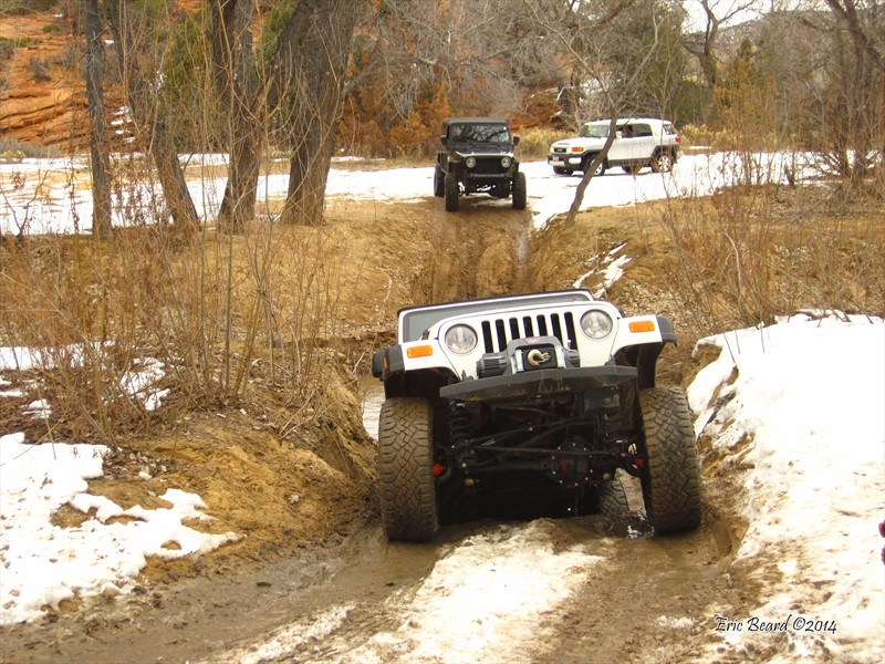
At the start of the trail, you are on two- track sandy road for several miles, then you will reach a couple of sandstone canyons with a couple of climbs. The second climb is an off-camber turn that is tricky on snow. If it is icy, it may require a winch. The sandhill to the river is steep, but in winter the sand is moist and not too difficult. The first river crossing is muddy and the opposite bank can be slippery. There are several more slippery banks. In winter, there may be ice shelves on the banks. The trail leader will prerun the trail and update conditions at the drivers meeting the morning of the run.
Trail Rating

Trail Notes
Length: 20 miles on trail, 115 miles highway and county rdMin Tire Size: 31+ inches
Winch: No
Front Locker: No
Rear Locker: No
Trail Gallery